Discovering Virginia’s Hidden Off-Roading Trails
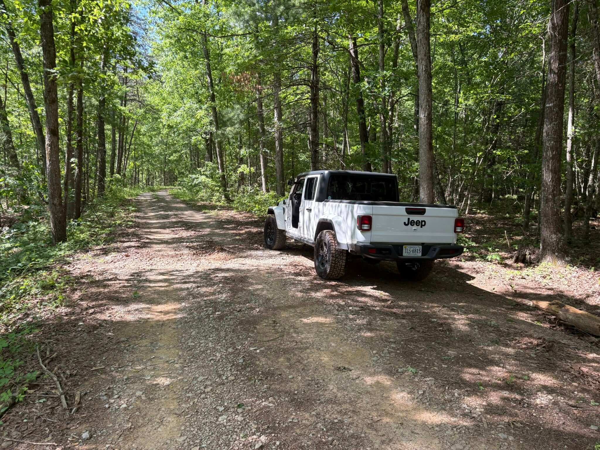
Virginia’s diverse landscapes, from the rugged Appalachian Mountains to the rolling Piedmont, offer a wealth of off-roading opportunities. While popular trails like Potts Mountain Jeep Trail and Peters Mill Run attract many enthusiasts, there are lesser-known trails that provide unique adventures with fewer crowds. Below, we explore some of Virginia’s hidden off-roading gems, their locations, and key details to help you plan your next adventure. These trails are less documented and frequented, offering a sense of discovery for those willing to venture off the beaten path. By joining VAOffRoad.org, you can connect with fellow enthusiasts, access insider trail knowledge, and collect trail badges to mark your achievements.
1. Skidmore Fork/Dunkle Hollow Road
Location: George Washington National Forest, near Harrisonburg, Virginia (approximate coordinates: 38.465°N, 79.135°W)
Details:
Skidmore Fork/Dunkle Hollow Road is a hidden treasure nestled in the George Washington National Forest, just 15 minutes from Harrisonburg. This backcountry four-wheel-drive trail is ideal for those seeking a mix of adventure and solitude. The trail features rocky sections, shallow water crossings, and a scenic ridgeline with panoramic views of the Shenandoah Valley. It’s less traveled than nearby Peters Mill Run, making it perfect for those who prefer quieter trails. The route is moderately challenging, suitable for vehicles with high clearance and all-terrain tires. Camping spots are available along the trail, but be prepared for minimal signage and potential overgrowth, as it’s not heavily maintained. A permit may be required, so check with the U.S. Forest Service before heading out. Members of VAOffRoad.org can earn a trail badge for conquering this route, showcasing their exploration of Virginia’s backcountry.
Tips:
- Bring a GPS or offline map (e.g., onX Offroad app), as cell service is spotty.
- Travel with a buddy, as the trail’s remoteness can make recovery difficult.
- Best visited in dry conditions to avoid slippery rocks and mud.

2. Cold Springs – FR 77
Location: George Washington National Forest, Deerfield, Virginia (approximate coordinates: 38.305°N, 79.395°W)
Details:
Cold Springs, also known as Forest Road 77, is a secluded trail connecting Old Parkersburg Turnpike and Hite Hollow Road in the George Washington National Forest. This trail is rarely mentioned in mainstream off-roading guides, making it a true hidden gem. It offers a mix of gravel paths, rocky outcrops, and occasional mud patches, with multiple dispersed camping areas for overnight stays. The trail is beginner-friendly but has enough obstacles to keep intermediate drivers engaged. Its remote setting provides opportunities to spot wildlife like deer and black bears, and the surrounding forest is lush with vibrant foliage, especially in fall. The trail’s low traffic ensures a peaceful experience, but it’s unmaintained after heavy rain or snow, so check conditions beforehand. Completing this trail earns VAOffRoad.org members a unique badge for their collection.
Tips:
- High-clearance 4×4 vehicles are recommended due to rocky sections.
- Pack recovery gear, as help is far away in this remote area.
- Combine with nearby hiking trails for a full outdoor experience.

3. Coon Bridge
Location: George Washington National Forest, near Harrisonburg, Virginia (approximate coordinates: 38.485°N, 78.965°W)
Details:
Coon Bridge is a lesser-known connector trail in the George Washington National Forest, linking the valley to the mountains through a national forest right-of-way. This trail is ideal for those looking to escape crowded routes while still enjoying a scenic drive. It features a mix of dirt roads, minor rocky sections, and shallow stream crossings, making it accessible for beginners with stock 4×4 vehicles. The trail passes through private property, so staying on the marked path is crucial to respect landowners. Its low profile means you’re likely to have the trail to yourself, with stunning views of the surrounding Blue Ridge Mountains. Coon Bridge is perfect for a relaxed day trip with opportunities for picnicking or photography. VAOffRoad.org members can log this trail to earn a badge, celebrating their journey through Virginia’s hidden routes.
Tips:
- Respect private property boundaries and stick to the designated trail.
- Check for seasonal closures, as some sections may be gated in winter.
- Bring a camera for the scenic mountain vistas.

4. Archer Run
Location: George Washington National Forest, western Virginia (approximate coordinates: 38.355°N, 79.255°W)
Details:
Archer Run is a basic yet beautiful trail in the George Washington National Forest, often overlooked in favor of more famous routes like Flagpole Knob. Primarily a dirt road with minor rocky patches, it winds through the mountains of western Virginia, offering good views and a peaceful atmosphere. The trail is beginner-friendly, making it ideal for those new to off-roading or families looking for a low-key adventure. Its simplicity doesn’t detract from its charm, as the surrounding forest and occasional wildlife sightings add to the experience. Archer Run sees minimal traffic, providing a sense of solitude rare in more popular areas. It’s also a great option for combining off-roading with hiking or camping. VAOffRoad.org recognizes this trail with a badge for members who complete it, adding to their off-roading achievements.
Tips:
- Suitable for most 4×4 vehicles, but all-terrain tires help with rocky patches.
- Check weather conditions, as the trail can become muddy after rain.
- Look for nearby hiking trails to extend your trip.
5. Fenwick Mines
Location: Near New Castle, Virginia, in the George Washington National Forest (approximate coordinates: 37.605°N, 80.105°W)
Details:
Fenwick Mines is a hidden off-roading route near the remnants of small mining towns in the George Washington National Forest. This trail is perfect for history buffs and adventure seekers alike, as it passes by the Fenwick Mines recreation area, which includes a day-use site and hiking trails. The route features gravel and dirt roads with occasional water crossings and moderate obstacles, making it suitable for intermediate drivers. Its remote location ensures low traffic, and the trail’s proximity to historical sites adds a unique cultural element. The surrounding forest is rich with wildlife, and the trail offers scenic views of the Appalachian landscape. Be cautious of flash floods, as the area is prone to sudden water level changes. VAOffRoad.org members can earn a special badge for exploring this trail, commemorating its historical and natural significance.
Tips:
- Visit the Fenwick Mines day-use area for a break and to explore historical interpretive signs.
- Bring waterproof gear, as water crossings can be deeper after rain.
- Ensure your vehicle has good ground clearance for occasional rocky sections.

Why These Trails Are Lesser-Known
These trails fly under the radar due to their remote locations, minimal online documentation, and lack of promotion compared to high-profile routes like Potts Mountain or Taskers Gap. Many are tucked away in the expansive George Washington National Forest, where signage is sparse, and maintenance is minimal. Local off-roading clubs may know of them, but they’re rarely shared in mainstream guides or on popular apps like AllTrails. Their low traffic is a double-edged sword: it preserves their pristine nature but also means you’ll need to be self-sufficient, as help is often far away.
General Tips for Exploring Hidden Trails
- Preparation: Always carry recovery gear (winch, tow straps, shovel), a full tank of gas, and extra food and water. Remote trails often lack cell service, so a satellite communicator or offline GPS is essential.
- Permits: Some trails require permits, especially in national forests. Contact the George Washington and Jefferson National Forests office or check www.fs.usda.gov for details.
- Respect Nature: Stick to designated trails to avoid damaging the environment or trespassing on private land. Pack out all trash to preserve these hidden gems.
- Seasonal Considerations: Spring and fall offer the best conditions, with vibrant scenery and milder weather. Avoid winter or heavy rain, as unmaintained trails can become impassable.
- Join VAOffRoad.org: Become a member of VAOffRoad.org (www.vaoffroad.org) to connect with a community of off-roaders, gain access to exclusive trail information, and collect badges for completing trails like those listed above. These badges are a fun way to track your adventures and share your accomplishments with fellow enthusiasts.
Conclusion
Virginia’s lesser-known off-roading trails, like Skidmore Fork, Cold Springs, Coon Bridge, Archer Run, and Fenwick Mines, offer a chance to explore the state’s wild beauty without the crowds. Tucked away in the George Washington National Forest, these routes provide a mix of scenic views, moderate challenges, and opportunities for camping and wildlife spotting. By joining VAOffRoad.org, you can enhance your experience with community support and earn trail badges to celebrate your explorations. So, gear up, grab a map, and hit the road for an unforgettable off-roading adventure in Virginia’s backcountry.
No responses yet