

Overview
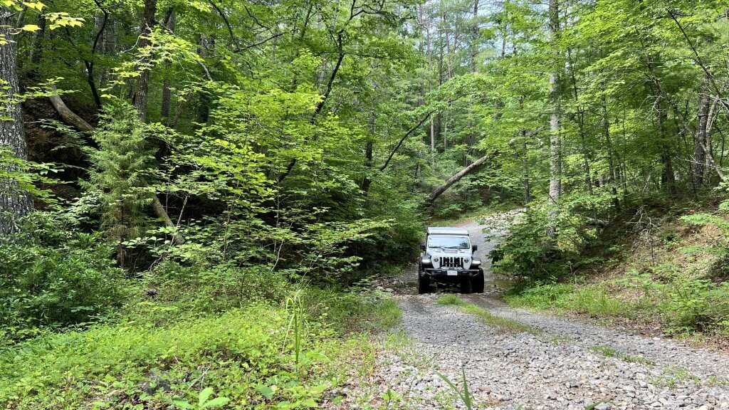
Nestled within Craig County, Virginia, Patterson Creek Trail Road is a scenic 7.2-mile gravel track (Forest Service Road 184) that follows alongside Patterson Creek in the George Washington & Jefferson National Forest. Surrounded by lush tree canopies, this multi‑purpose corridor offers a serene escape for off‑road drivers, campers, hikers, and gravel cyclists.
We’ve chosen not to put this trail on our trail guides because it’s a very easy trail, you can do it in a 2WD vehicle.
Trail Experience
- Route & Difficulty
Rated a moderate “2” out of 5 on off‑road difficulty scales, the trail is mostly smooth and wide enough for two‑way vehicle traffic- We actually rate this a 1 - Creek Crossings
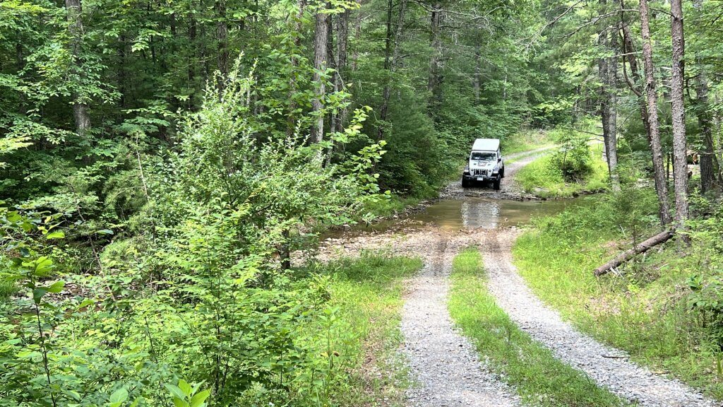
Travelers encounter several creek fords—typically under a foot deep in dry weather, but certain crossings on the northeastern segment can swell beyond three feet during heavy rains - Campsites
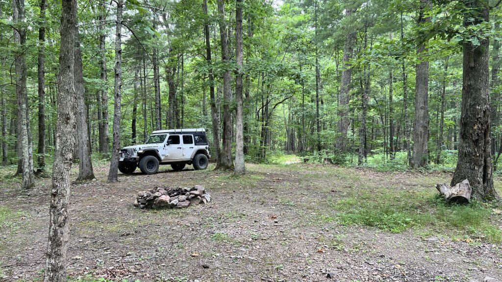
Roughly a dozen dispersed campsites dot the trail, many large enough to accommodate vehicles and pitch tents beside the creek - Cell Reception
Expect limited to no cell service along much of the trail
Seasonal Insights
- Best Time to Visit
Fall is ideal: the trail is drivable, the foliage is vibrant, and weather is typically more stable - Rain Watch
The creek crossings can become fast-moving streams after storms. Approach with caution, or postpone your trip if water levels are high .
Trail Activities
- Off-Road Driving
ATV-friendly and open to high-clearance vehicles, the trail offers a laid-back yet immersive off-road experience. Users report light mud, gravel, and occasional wildlife sightings—black bears included - Gravel Biking & Hiking
The gently rolling terrain under dappled light makes it appealing for gravel cyclists and hikers, although the focus remains on the road itself - Extended Trail Network
The road provides access to the broader Patterson Creek Trail System—hiking and biking routes revived by Roanoke’s IMBA chapter, featuring loops and off-road challenges in Craig and Botetourt counties
Getting There
Located ~10 miles northwest of Fincastle, VA, off Route 606, with parking available at trailheads including the Hebron Road intersection. Expect minimal facilities—arrive prepared.
Trail Highlights at a Glance
| Feature | Details |
|---|---|
| Length | ~7.2 miles |
| Surface | Gravel, tree canopy |
| Crossings | Multiple creek fords (variable depth) |
| Campsites | ~12 dispersed sites |
| Difficulty | Moderate (off‑road rating 1/5) |
| Best Season | Fall (dry conditions ideal) |
| Cell Service | Spotty to non-existent |
User Experiences
- A 2015 Toyota 4Runner user reported “3–5 small water crossings… saw a young black bear. Any vehicle with little clearance can take the drive and enjoy the trail.”
- A Ford Bronco drive in 2022: “Longer wheelbase vehicles will need to take creek crossings slowly… did the whole trail in 2WD.”
Planning Your Trip
- Check Weather & Conditions
Creek depth changes quickly—verify recent rainfall before heading out. - Vehicle Choice
High-clearance 2WD vehicles are generally sufficient; AWD or 4WD recommended for wet seasons. - Gear & Supplies
Bring water, food, a first-aid kit, and navigation tools—services and cell signal are scarce. - Camping Setup
Dispersed camping permitted—select flat, durable surfaces and follow Leave No Trace. - Explore Nearby Trails
Extend your adventure into the Patterson Creek Trail System, or venture onto Price and North Mountains with expansive Wild Area routes
Final Thoughts
Patterson Creek Trail Road delivers a charming blend of light off-road driving, creekside campsites, and beautiful forest ambiance—ideal for those seeking a relaxed outdoor retreat. Whether you’re driving, biking, or hiking, this trail offers refreshingly isolated pathways within Virginia’s scenic Appalachians.
Would you like help with directions, seasonal tips, or connecting this to other nearby trails? Just let me know!
No responses yet